test-start: Unterschied zwischen den Versionen
Aus kvwmap
Rahn (Diskussion | Beiträge) |
|||
| Zeile 1: | Zeile 1: | ||
<!-- Block 1 --> | <!-- Block 1 --> | ||
| − | <div id="start-block1" style="width: | + | <div id="start-block1" style="width: auto; position: relative; margin: 1%; padding: 0; background: #fafafa; box-shadow: rgba(149, 157, 165, 0.2) 0px 8px 24px; border: 1px solid #ccc; border-radius: 5px; color: #666; cursor: default;"> |
| − | <div style="width: 60%; padding: 3% | + | <div style="width: 60%; padding: 3% 1%; display: flex; flex-direction: column; cursor: default;"> |
<div style="height: 100%; font-size: 3em; line-height: 100%; color: #3976aa">kvwmap</div> | <div style="height: 100%; font-size: 3em; line-height: 100%; color: #3976aa">kvwmap</div> | ||
<div style="height: 100%; margin: 3% 0; font-size: 1.5em; line-height: 100%;">Ein Open Source WebGIS-Framework zur Erfassung, Verarbeitung, Analyse und Präsentation von raumbezogenen Informationen</div> | <div style="height: 100%; margin: 3% 0; font-size: 1.5em; line-height: 100%;">Ein Open Source WebGIS-Framework zur Erfassung, Verarbeitung, Analyse und Präsentation von raumbezogenen Informationen</div> | ||
| Zeile 12: | Zeile 12: | ||
<!-- Block 2 --> | <!-- Block 2 --> | ||
| − | <div id="start-block2" style="width: | + | <div id="start-block2" style="width: auto; position: relative; margin: 1%; padding: 0; border-radius: 5px; color: #666; cursor: default;"> |
| − | <div style="width: | + | <div style="width: auto; height: 98%; display: flex; justify-content: space-around; align-items: stretch;"> |
| − | <div class="start-block2-box"> | + | <div class="start-block2-box" style="padding: 1%; border: 1px solid #ccc; border-radius: 5px; background: #fafafa; box-shadow: rgba(149, 157, 165, 0.2) 0px 8px 24px;"> |
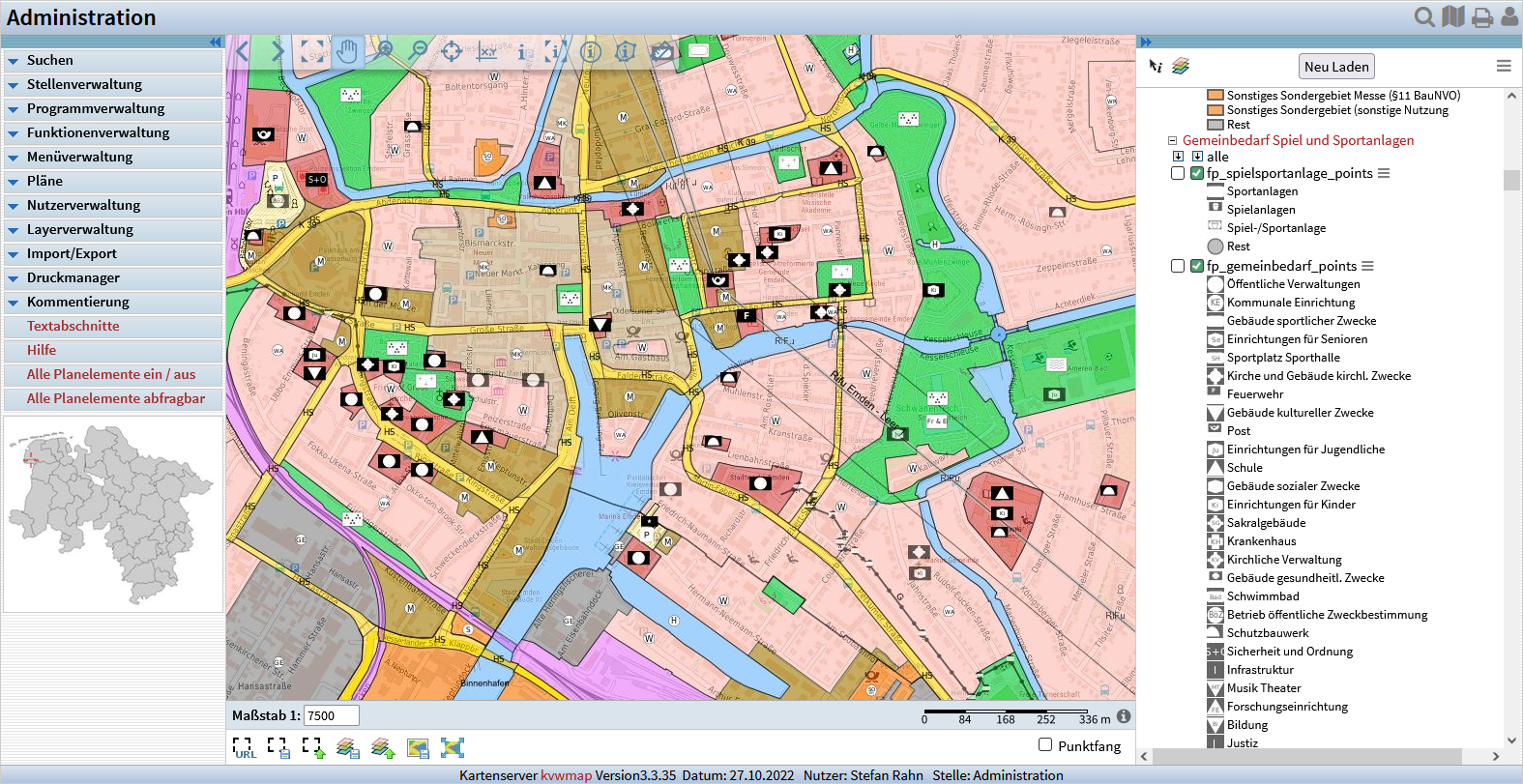
[[Datei:kvwmap-start.png|class=halfwidth|left]] | [[Datei:kvwmap-start.png|class=halfwidth|left]] | ||
</div> | </div> | ||
| − | <div class="start-block2-box" style="background: # | + | <div class="start-block2-box" style="border: 1px solid #ccc; border-radius: 5px; background: #fafafa; box-shadow: rgba(149, 157, 165, 0.2) 0px 8px 24px; display: flex; align-items: center;"> |
| − | <div style="padding: 3% | + | <div style="padding: 3%; display: flex; flex-direction: column; align-items: strech; justify-content: space-evenly; height: 100%;"> |
<p><span style="font-weight: bold;">PHP</span>-Implementierung</p> | <p><span style="font-weight: bold;">PHP</span>-Implementierung</p> | ||
<p><span style="font-weight: bold;">OpenSource</span> GIS-Komponenten: UMN-MapServer, PostgreSQL/PostGIS, OGC, OGR, ...</p> | <p><span style="font-weight: bold;">OpenSource</span> GIS-Komponenten: UMN-MapServer, PostgreSQL/PostGIS, OGC, OGR, ...</p> | ||
| Zeile 31: | Zeile 31: | ||
<!-- Block 3 --> | <!-- Block 3 --> | ||
| − | <div id="start-block3" style="width: | + | <div id="start-block3" style="width: auto; height: 100%; position: relative; margin: 1%; padding: 0 5%; border: 1px solid #ccc; border-radius: 5px; background: #fafafa; box-shadow: rgba(149, 157, 165, 0.2) 0px 8px 24px; color: #666; display: flex; flex-direction: column; cursor: default;"> |
<div style="display: flex; align-items: center; justify-content: center; margin: 5%;"> | <div style="display: flex; align-items: center; justify-content: center; margin: 5%;"> | ||
<div style="border: 3px solid #b5dde3; background-color: #86c2cb; padding: 5px 10px; font-size: 1.5em;"> | <div style="border: 3px solid #b5dde3; background-color: #86c2cb; padding: 5px 10px; font-size: 1.5em;"> | ||
| Zeile 60: | Zeile 60: | ||
<!-- Block 4 --> | <!-- Block 4 --> | ||
| − | <div id="start-block4" style="width: | + | <div id="start-block4" style="width: auto; height: 100%; position: relative; margin: 1%; padding: 0; border: 1px solid #ccc; border-radius: 5px; background: #fafafa; box-shadow: rgba(149, 157, 165, 0.2) 0px 8px 24px; color: #666; cursor: default; display: flex; flex-direction: row; flex-wrap: wrap; align-items: stretch; justify-content: space-evenly;"> |
| − | <div style="text-align: center; padding: 3em 0 | + | <div style="text-align: center; padding: 3em 0; flex-basis: 25%;"> |
<h3>Download GitHub</h3> | <h3>Download GitHub</h3> | ||
<div style="width: 50%; height: 1px; margin-left: 25%; margin-top: 1.5em; border: 0; background: #dbdbdb;"></div> | <div style="width: 50%; height: 1px; margin-left: 25%; margin-top: 1.5em; border: 0; background: #dbdbdb;"></div> | ||
| Zeile 75: | Zeile 75: | ||
</p> | </p> | ||
</div> | </div> | ||
| − | <div style="text-align: center; padding: 3em 0 | + | <div style="text-align: center; padding: 3em 0; flex-basis: 25%;"> |
<h3>Print-Material</h3> | <h3>Print-Material</h3> | ||
<div style="width: 50%; height: 1px; margin: 1.5em 25% 1.2em 25%; border: 0; background: #dbdbdb;"></div> | <div style="width: 50%; height: 1px; margin: 1.5em 25% 1.2em 25%; border: 0; background: #dbdbdb;"></div> | ||
| Zeile 83: | Zeile 83: | ||
<p><span class="plainlinks">[http://www.kvwmap.de/kvwmap_fach.pdf kvwmap-Flyer2]</span></p> | <p><span class="plainlinks">[http://www.kvwmap.de/kvwmap_fach.pdf kvwmap-Flyer2]</span></p> | ||
</div> | </div> | ||
| − | <div style="text-align: center; padding: 3em 0 | + | <div style="text-align: center; padding: 3em 0; flex-basis: 25%;"> |
<h3>kvwmap im WWW</h3> | <h3>kvwmap im WWW</h3> | ||
<div style="width: 50%; height: 1px; margin: 1.5em 25% 1.2em 25%; border: 0; background: #dbdbdb;"></div> | <div style="width: 50%; height: 1px; margin: 1.5em 25% 1.2em 25%; border: 0; background: #dbdbdb;"></div> | ||
Version vom 11. November 2022, 12:53 Uhr
kvwmap
Ein Open Source WebGIS-Framework zur Erfassung, Verarbeitung, Analyse und Präsentation von raumbezogenen Informationen
PHP-Implementierung
OpenSource GIS-Komponenten: UMN-MapServer, PostgreSQL/PostGIS, OGC, OGR, ...
Leistungsfähige Nutzer- und Rollenverwaltung
Ausgereifte Fachschalen für die Präsentation von ALKIS-Daten
Generische Erzeugung von Fachschalen zur Präsentation und Bearbeitung eigener Daten
Plugin-Schnittstelle für eigene Fachschalen
Konferenzbeiträge:
2018
2016
2011
2010
2009
2008
2007
2006
2005
2004
